Total Area- 923,768 sq km
Land Area- 910,768 sq km
Water Area- 13,000 sq km
Size Comparative to US Territory- About six times the size of Georgia and a little bit more than twice the size of California
Bordering Countries- Benin, Cameroon, Chad, Niger
Total DIstance of all Land Boundaries- 4,477 km
Total Distance of Coastline- 853 km
Description of Climate- The climate varies with equatorial in south, tropical in center, and arid in north
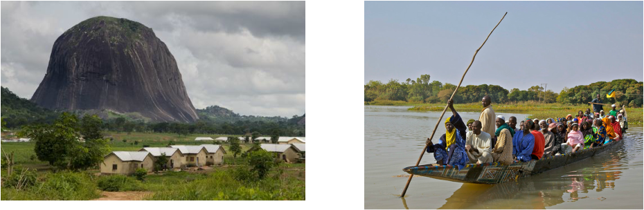
Description of Terrain- Terrain includes southern lowlands that merge into central hills and plateaus; mountains in the southeast, and plains in the north
Point of Lowest Elevation- Atlantic Ocean at 0 m
Point of Highest Elevation- Chappal Waddi at 2,419 m
Land Area- 910,768 sq km
Water Area- 13,000 sq km
Size Comparative to US Territory- About six times the size of Georgia and a little bit more than twice the size of California
Bordering Countries- Benin, Cameroon, Chad, Niger
Total DIstance of all Land Boundaries- 4,477 km
Total Distance of Coastline- 853 km
Description of Climate- The climate varies with equatorial in south, tropical in center, and arid in north
Description of Terrain- Terrain includes southern lowlands that merge into central hills and plateaus; mountains in the southeast, and plains in the north
Point of Lowest Elevation- Atlantic Ocean at 0 m
Point of Highest Elevation- Chappal Waddi at 2,419 m
Regional Map-

Country Specific Map-

Capital City on Google Maps-

